 Subscribe to the Coal Tattoo
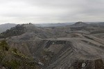
Mountaintop removal: More on the floods
May 11, 2009 by Ken Ward Jr.

West Virginia Gov. Joe Manchin looks at an overturned car Sunday afternoon, May 10, in North Matewan, W.Va., after the car and several other vehicles were washed down a stream during flash flooding Saturday. Manchin toured much of Mingo County, W.Va., where the flash flood destroyed homes and property. (AP Photo/Michael Browning/ The Logan Banner)
Word about the damage from the Southern West Virginia flooding is not good, especially in Mingo County. But we’re not hearing much out of political leaders about whether mountaintop removal might have played a role in this round of flooding, which has destroyed hundreds of homes and other buildings in the Heart of the Billion-Dollar Coalfield.
I’ve gotten a few calls and e-mails from folks about this, and the some of the comments on out Web site are making out like the Gazette is part of some conspiracy to cover this up for the industry. I’m sure there are a few coal company folks who follow Coal Tattoo who are getting a kick out of that.
I blogged yesterday about the seven coal miners who were successfully rescued from a flooded underground mine in Mingo County, and I also pointed out where folks could find some of the strong science that indicates large-scale surface mining can make flooding more likely and more damaging in places like the narrow hollows of Appalachia.
Today, I tried to check on every report I got of a spot where residents felt it was obvious that a strip mine site caused or contributed to their flooding. (If you know of such a situation, please e-mail me here with the information).
And so far, I’ve only been able to confirm one specific problem — near the community of Thacker, where a sediment ditch failed on Saturday, sending mining runoff pouring down and blocking a local road.
Thacker resident Judy Daniels told me she feared the floodwaters were and debris from the mine were going to destroy her home:
It was like lava coming off the mountain, and it was coming straight toward our home. Â It was not a mudslide. It has something to do with mining.

Frank Manuel, above left, and his brother, Ralph Manuel, clear debris from a bridge at Varney, W.Va., Saturday, May 9, 2009, after flash floods washed through Mingo County, W.Va. (AP Photo/The Logan Banner, Michael Browning)
Luckily, the rushing water and debris took a turn and missed the Daniels’ home. But it did block the local road, and the company involved sent a crew late Saturday night to clean up the mess.
Randy Huffman, secretary of the West Virginia Department of Environmental Protection, said his inspectors cited Central Appalachian Mining for the incident.
Huffman said that was the only incident where an active mining permit had caused or contributed to any flooding problems, at least as far as he heard from DEP inspectors. And in this case, he said, the sediment ditch was built — perhaps improperly — on top of some pre-law (prior to the 1977 mining act) waste.
“It just didn’t have the stability that it needed and it washed out,” Huffman told me. He said DEP would be looking at whether the problem was or should have been picked up on and corrected during the permitting process.
But Huffman also explained to me that he has a friend who lives on Gilbert Creek in Mingo County. That friend has a rain guage, he said. And from Thursday through Saturday, that location got more than 7 inches of rain. I’m not sure that I’ve seen exact rain figures published yet — and I don’t have all of them myself — but here’s some that I do have, for the 24-hour period from 8 a.m. Friday to 8 a.m. Saturday:
Mullins — 3.02 inches
Pineville — 3.95 inches
Oceana — 2.76 inches
Iaeger — 2.75 inches
War — 1.64 inchesÂ
One Associated Press story I saw included the inevitable quote from a state official, this time from Robert Jelacic, spokesman for the state Division of Homeland Security and Emergency Management. Well, it’s actually a paraphrase:
Several coal mines operate in the region, but there has been no determination if mining or forestry operations played a role in the runoff, Jelacic said.
I couldn’t really get a handle from Randy Huffman about how much digging his agency was going to do on this issue. I guess time will tell.
UPDATED: DEP spokeswoman Kathy Cosco says agency inspectors have also cited a Rawl Sales operation in Mingo County because two culverts failed, sending water into the yards and basements of nearby homes.
And let’s make one thing clear: The lack of a citation from DEP for violating a permit is not proof that a particular mining operation did not contribute to flooding. As I wrote yesterday, the science leaves little question that such large-scale land disturbances contribute to increased runoff and flooding.
But citizen groups are out there making an issue of it. The Ohio Valley Environmental Coalition, for example, sent out a “Call for Volunteers” to help its members in the Mingo County area clean up after the floods. It got picked up by the It’s Getting Hot in Here blog and by the Alliance for Appalachia.
Finally, I had a note from journalist Penny Loeb, who rightly suggested that I point Coal Tattoo readers to her collection of information about coalfield floods, available online here.
And I also, with Penny’s kind permission, and posting a story she did for Southern Exposure about coalfield flooding. It’s here.